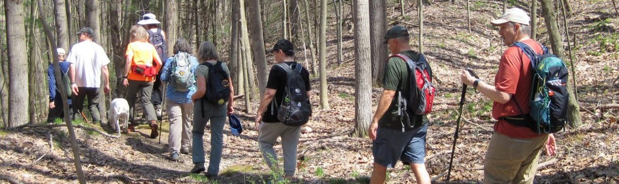
BOC Ramble – Wednesday, September 17th at 5:30PM (Jennings Environmental Education Center)
| Please join us for a leisurely 2 mile hike thru the prairie ecosystem at Jennings Environmental Education Center. Meet at the prairie side parking lot. This is a loop hike, no shuttle. GPS Coordinates: 41.009188585930595, -80.00499390453179 The Center is located at 2951 Prospect Road, Slippery Rock, PA |
BOC Weekday Bike Ride – Tuesday, September 23rd at 11:00 AM (Moraine State Park)
| Please join us for a bike ride at Moraine State Park on September 23rd at 11 AM. We’ll meet at the bike rental. We’ll ride from the bike rental to Davis Hollow Marina and return. The total distance is about 16 miles but you can turn around at any time. The address is 157 N Shore Dr, Portersville, PA 16051. GPS Coordinates: 40.974444670776116, -80.12855364302345 |
BOC Fall Foliage Bike Ride – Saturday, October 11th at 11:00AM (Allegheny River Trail – Emlenton)
| Allegheny River Trail – Out and Back Emlenton trailhead to turn around point situated one mile beyond the Kennerdell tunnel. This is the point where the paved Allegheny River Trail becomes an unpaved road. Total Mileage: 27.3 Take I-80 East to Emlenton Exit #42. Take Route 208 East to Emlenton. Cross the Allegheny River into Emlenton. Take a left at the stop sign. Parking is ahead on the right. Parking at the trailhead at this time of the year can be “iffy” as many riders take advantage of seeing the fall colors on the river trail. An alternative area for parking is the Emlenton post office. This parking lot is located on the right side of main street – just before entry to the main trailhead parking area. The Emlenton Truck Plaza at Exit 42 has civilized facilities. There may be a port-a-john box at the Emlenton trailhead. This box is pulled at some point at the end of the riding season. It may (or may not) be there. There are no facilities along the trail… other than what you may discover. We will gather for our ride at 11:00 AM at the start of the trail. This spot is located in the trailhead parking area and marked by yellow bollards. We’ll check roll call and waiver sign offs and then head out for the quiet scenic beauty of the ART. Lights are recommended in the Kennerdell and Rockdale tunnels for your safety as well as the safety of others. Post Ride Social Time (Optional) Two establishments – both associated with each other and located side-by-side on the main street. Food from “Little It” may be brought into the “50 Shades” establishment. “50 Shades” opens at 2:00 PM on Saturdays; hence the 11:00 AM start time. Sleep in – ride in the autumn colors – eat Italian food – have a glass of wine or mug of beer. There’s no better offer out there. Please notify Tom V. or Rich T. if you plan to attend at creekfishing40@gmail.com or rich1946.rt@gmail.com in case we have to cancel because of the weather. GPS Coordinates: 41.1780828981153, -79.71510756326151 |
BOC Bike Ride – Saturday, October 18th at 11:00 AM (Little Beaver Creek Greenway Trail, Ohio)
| Ride is 20 Miles total – 10 miles out with a flip and a return via the same route. Riders have the option of turning around at any point. The ride starts at the trailhead train station parking area at 232 South Market Street in Lisbon. The course is paved, in excellent condition, very scenic, and 95% shaded. BOC has never ridden this course which is very highly rated by other riders. We guarantee you will be pleasantly surprised by this gem. We will pause at a picnic pavilion area located at the 10-mile turnaround point for rest, and social time with self-supplied snacks. There are clean, civilized restrooms in the train station building located at the trailhead parking area @ 232 South Market Street. Additionally, there are clean and well-maintained port-a-johns at two locations along the 10-mile course. GPS Coordinates: 40.7699977452708, -80.76737591476468 |
BOC Annual Dinner – Saturday, November 8th at 5:00PM (East Butler Fire Hall)
| 31st Annual Dinner (Saturday, Nov. 8, 2025) East Butler Fire Hall 808 Grant Ave. East Butler, PA Social Time/Silent Auction starts at 5:00 pm with Dinner at 6:00 pm – Public welcome ———————————————————————————————— Catering by Fairground Market: Stuffed pork chop or stuffed chicken breast (Please specify which one), Parsley Red Potatoes, California Blend Vegetables and Tossed Salad with Apple and Pumpkin pie for dessert. —————————————————————————————————– Featured program to be presented by: Dale Luthringer – The Clarion River has an incredible and varied history, from well before our nation’s founding to the present. Join us as we take you from pre-European contact with the Indians and pristine old growth forests, to its lumber history, natural resource exploitation, and its current state of recovery. (Program to begin at 7:00 pm) ———————————————————————————————————- Prepaid Reservations only ($25 per person – must be received by Oct 26th) Mail check, names of attendees and meal choice (stuffed pork chop or stuffed chicken breast) to Carol at: Butler Outdoor Club 133 Boozel Road Slippery Rock, PA 16057 |
Last updated: 9/14/25